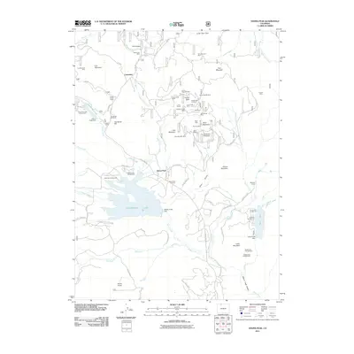
2011 Map of Hahns Peak
USGS Topo · Published 2011About this map
Mining heritage and recreational landmarks dominate this northern Colorado landscape at the start of the 21st century. The legacy of extraction is visible across the terrain, with numerous shafts and workings such as the Royal Flush Mine, Minnie D Mine, and the Price Tunnel clustered near the distinctive summits of Hahns Peak and Little Mountain. The settlement at Columbine serves as a northern hub, while further south, the massive expanse of Steamboat Lake and its surrounding Steamboat Lake State Park highlight the region's modern transition to a premier destination for outdoor activity. Genealogy and local history researchers will find the Hahns Peak Cemetery positioned near the town site of the same name, which remains a focal point along County Highway 129. The map also captures several campgrounds, including Poverty Bar Campground and Sunrise Vista Campground, indicating the area's development for tourism.
Find a feature on this map
79 named features on this map. Tap any name to fly to it.
Don’t see what you’re looking for? This feature index may not catch every label — zoom into the map to look around manually.
Map Details
Editions of this 2011 Hahns Peak Map
This is the sole edition of this map. No revisions or reprints were ever made.
Other maps of this area

1911 · Hahns Peak
USGS Topo · 1:125,000

1913 · Hahns Peak
USGS Topo · 1:125,000

1923 · Pilot Knob
USGS Topo · 1:62,500

1925 · Pilot Knob
USGS Topo · 1:62,500

1954 · Craig
USGS Topo · 1:250,000

1957 · Craig
USGS Topo · 1:250,000

1958 · Craig
USGS Topo · 1:250,000

1960 · Craig
USGS Topo · 1:250,000

1962 · Craig
USGS Topo · 1:250,000
1962 · West Fork Lake
USGS Topo · 1:24,000