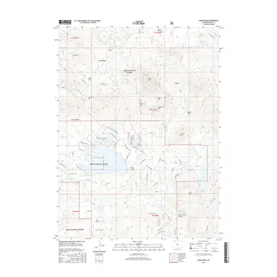
2016 Map of Hahns Peak
USGS Topo · Published 2016About this map
Columbine sits at the northern edge of this high-elevation landscape in the Routt National Forest, surrounded by a dense network of historic mining and pack trails. The prominent summit of Hahns Peak overlooks a region defined by its water and recreation, including the expansive Steamboat Lake and the smaller Pearl Lake to the southeast. Family history and local heritage are preserved at the Hahns Peak Cem, while the presence of Skyote Airport and modern residential naming conventions like Little Mountain Dr show the evolution of this mountain community.
Find a feature on this map
81 named features on this map. Tap any name to fly to it.
Don’t see what you’re looking for? This feature index may not catch every label — zoom into the map to look around manually.
Map Details
Editions of this 2016 Hahns Peak Map
This is the sole edition of this map. No revisions or reprints were ever made.
Other maps of this area

1911 · Hahns Peak
USGS Topo · 1:125,000

1913 · Hahns Peak
USGS Topo · 1:125,000

1923 · Pilot Knob
USGS Topo · 1:62,500

1925 · Pilot Knob
USGS Topo · 1:62,500

1954 · Craig
USGS Topo · 1:250,000

1957 · Craig
USGS Topo · 1:250,000

1958 · Craig
USGS Topo · 1:250,000

1960 · Craig
USGS Topo · 1:250,000

1962 · Craig
USGS Topo · 1:250,000
1962 · West Fork Lake
USGS Topo · 1:24,000