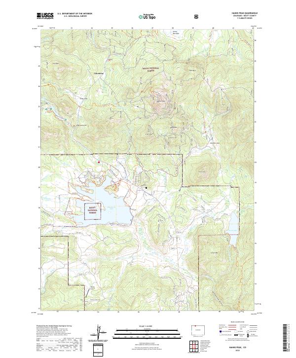
2022 Map of Hahns Peak
USGS Topo · Published 2022About this map
Hahns Peak dominates this section of the Routt National Forest, rising above a landscape defined by high-altitude basins and significant water features. The small settlement of Columbine sits to the northwest of the peak, while the Hahns Peak Cem remains a quiet landmark of the area's pioneer history. The map illustrates the shift toward recreational and modern infrastructure within the forest, featuring both Steamboat Lake and Pearl Lake, alongside the Skyote Airport further south near Red Cr.
Find a feature on this map
82 named features on this map. Tap any name to fly to it.
Don’t see what you’re looking for? This feature index may not catch every label — zoom into the map to look around manually.
Map Details
Editions of this 2022 Hahns Peak Map
This is the sole edition of this map. No revisions or reprints were ever made.
Other maps of this area

1911 · Hahns Peak
USGS Topo · 1:125,000

1913 · Hahns Peak
USGS Topo · 1:125,000

1923 · Pilot Knob
USGS Topo · 1:62,500

1925 · Pilot Knob
USGS Topo · 1:62,500

1954 · Craig
USGS Topo · 1:250,000

1957 · Craig
USGS Topo · 1:250,000

1958 · Craig
USGS Topo · 1:250,000

1960 · Craig
USGS Topo · 1:250,000

1962 · Craig
USGS Topo · 1:250,000
1962 · West Fork Lake
USGS Topo · 1:24,000