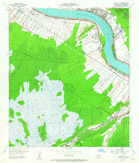
1952 Map of Hahnville
USGS Topo · Published 1962About this map
The Mississippi River defines the northern arc of this St. Charles Parish landscape, where the riparian settlements of Hahnville, Taft, and Killona sit atop the natural levees. This mid-century view shows an economy transitioning from traditional riverbound commerce to industrial expansion, anchored by a large Oil Refinery near Good Hope and the developing Paradis Oil Field to the south. The complex hydrology of the region is evident in the massive Bonnet Carre Floodway and a dense network of drainage channels like the Eighty Arpent Canal and Vial Canal, which manage the low-lying wetlands. Beyond the riverfront, the map details established community life through landmarks such as Mt Airy Church, Paradis School, and the St Charles Cemetery. Multiple rail lines, including the Texas and Pacific Railroad and Southern Pacific Railroad, intersect the parish, connecting these Mississippi River communities to the broader Gulf Coast infrastructure.
Find a feature on this map
50 named features on this map. Tap any name to fly to it.
Don’t see what you’re looking for? This feature index may not catch every label — zoom into the map to look around manually.
Map Details
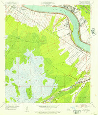
Editions of this 1952 Hahnville Map
2 editions found
Other maps of this area

1891 · Hahnville
USGS Topo · 1:62,500

1892 · Lac Des Allemands
USGS Topo · 1:62,500

1892 · Mount Airy
USGS Topo · 1:62,500

1892 · Bonnet Carre
USGS Topo · 1:62,500

1932 · Lac Des Allemands SE
USGS Topo · 1:31,680

1932 · Hahnville NW
USGS Topo · 1:31,680

1932 · Lac Des Allemands NE
USGS Topo · 1:31,680

1932 · Hahnville SW
USGS Topo · 1:31,680

1932 · Hahnville NE
USGS Topo · 1:31,680

1935 · Laplace
USGS Topo · 1:31,680