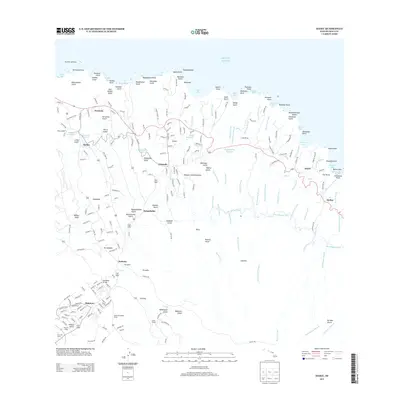
2013 Map of Haiku
USGS Topo · Published 2013About this map
Pauwela Lighthouse stands as a sentinel over the jagged coastline of northern Maui, where the land breaks into numerous points and bays such as Eleilei Bay and Hoolawa Bay. The 2013 landscape is defined by the deep incisions of gulches like Kuiaha Gulch and Honokalā Gulch which carry water from the interior highlands toward the Pacific. The agricultural and industrial heritage of the region is evident in the water management systems, notably the New Hāmākua Ditch and several reservoirs including Haiku Reservoir and Pauwela Reservoir.
Find a feature on this map
222 named features on this map. Tap any name to fly to it.
Don’t see what you’re looking for? This feature index may not catch every label — zoom into the map to look around manually.
Map Details
Editions of this 2013 Haiku Map
This is the sole edition of this map. No revisions or reprints were ever made.
Other maps of this area

1954 · Maui
USGS Topo · 1:250,000

1954 · Paia
USGS Topo · 1:24,000

1954 · Puu O Kali
USGS Topo · 1:24,000

1957 · Kilohana
USGS Topo · 1:24,000

1957 · Haiku
USGS Topo · 1:24,000

1957 · Nahiku
USGS Topo · 1:24,000

1957 · Keanae
USGS Topo · 1:24,000

1966 · Maui
USGS Topo · 1:250,000

1974 · Maui
USGS Topo · 1:250,000
1977 · Paia
USGS Topo · 1:24,000