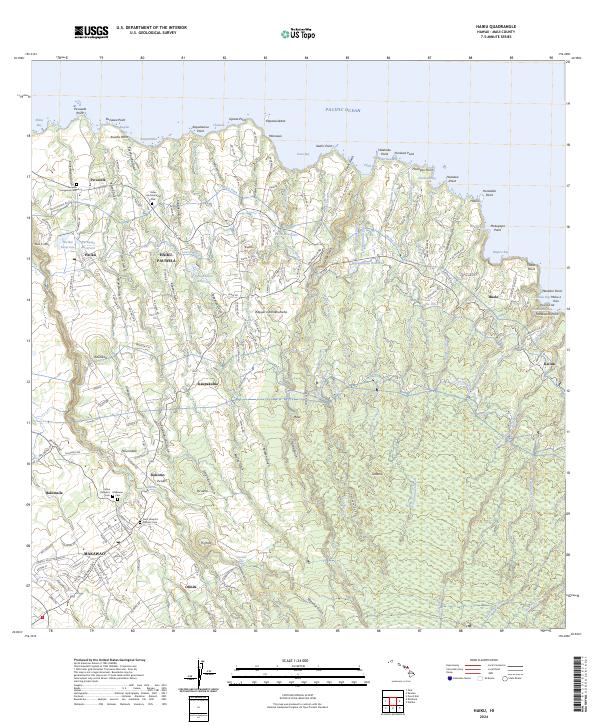
2024 Map of Haiku
USGS Topo · Published 2024About this map
Makawao and the north shore of Maui are characterized by a transition from the agricultural uplands near Olinda and Haliimaile to the deeply eroded gulches of the coastline. The landscape is interconnected by a complex system of water management features, including the Lowrie Ditch and several significant reservoirs such as Peahi Reservoir and Kaupakulua Reservoir. These structures, alongside the numerous streams like Honopou Stream and Hoolawa Stream, reflect the long-standing importance of water diversion for the region's agricultural development.
Find a feature on this map
194 named features on this map. Tap any name to fly to it.
Don’t see what you’re looking for? This feature index may not catch every label — zoom into the map to look around manually.
Map Details
Editions of this 2024 Haiku Map
This is the sole edition of this map. No revisions or reprints were ever made.
Other maps of this area

1954 · Maui
USGS Topo · 1:250,000

1954 · Paia
USGS Topo · 1:24,000

1954 · Puu O Kali
USGS Topo · 1:24,000

1957 · Kilohana
USGS Topo · 1:24,000

1957 · Haiku
USGS Topo · 1:24,000

1957 · Nahiku
USGS Topo · 1:24,000

1957 · Keanae
USGS Topo · 1:24,000

1966 · Maui
USGS Topo · 1:250,000

1974 · Maui
USGS Topo · 1:250,000
1977 · Paia
USGS Topo · 1:24,000