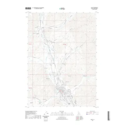
2020 Map of Hailey
USGS Topo · Published 2020About this map
Hailey and the surrounding Wood River Valley are depicted here at a period of established mountain settlement and modern infrastructure. The Big Wood River serves as the central geographic axis, flanked by the Wood River Path and a complex network of agricultural and municipal waterworks, including the Hiawatha Canal, Comstock Ditch, and Mizer Ditch. The town is the clear civic hub, anchored by the Blaine County Judicial Building and the Friedman Memorial Airport to the south.
Find a feature on this map
150 named features on this map. Tap any name to fly to it.
Don’t see what you’re looking for? This feature index may not catch every label — zoom into the map to look around manually.
Map Details
Editions of this 2020 Hailey Map
This is the sole edition of this map. No revisions or reprints were ever made.
Other maps of this area

1895 · Hailey
USGS Topo · 1:125,000

1897 · Hailey
USGS Topo · 1:125,000

1955 · Hailey
USGS Topo · 1:250,000

1957 · Bellevue
USGS Topo · 1:62,500

1957 · Bellevue
USGS Topo · 1:24,000

1959 · Hailey
USGS Topo · 1:250,000

1962 · Hailey
USGS Topo · 1:250,000

1967 · Baugh Creek SW
USGS Topo · 1:24,000

1967 · Mahoney Butte
USGS Topo · 1:24,000

1967 · Sun Valley
USGS Topo · 1:24,000