
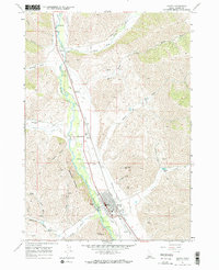
1967 Map of Hailey
USGS Topo · Published 1971About this map
Big Wood River serves as the central artery for this high-altitude landscape, where the valley floor supports a complex irrigation network including the Hiawatha Canal and Justus Ditch. The town of Hailey is the primary hub, showing a structured street grid anchored by the Union Pacific railroad and the Hailey Station. Beyond the residential blocks, the local infrastructure is clearly defined by the Friedman Memorial Airport, a Heliport, and several specialized facilities like the Hailey Hot Springs Reservoir. Steep canyon walls rise sharply from the valley, named for local landmarks like Red Devil Mtn and Carbonate Mountain. The map records a working landscape of mineral extraction and water management, with numerous mines and prospects scattered through Ohio Gulch and Quigley Creek, illustrating the intersection of aviation, mining, and ranching in the late 1960s.
Find a feature on this map
49 named features on this map. Tap any name to fly to it.
Don’t see what you’re looking for? This feature index may not catch every label — zoom into the map to look around manually.
Map Details
Editions of this 1967 Hailey Map
2 editions found
Other maps of this area

1895 · Hailey
USGS Topo · 1:125,000

1897 · Hailey
USGS Topo · 1:125,000

1955 · Hailey
USGS Topo · 1:250,000

1957 · Bellevue
USGS Topo · 1:62,500

1957 · Bellevue
USGS Topo · 1:24,000

1959 · Hailey
USGS Topo · 1:250,000

1962 · Hailey
USGS Topo · 1:250,000

1967 · Baugh Creek SW
USGS Topo · 1:24,000

1967 · Mahoney Butte
USGS Topo · 1:24,000

1967 · Sun Valley
USGS Topo · 1:24,000