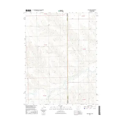
2016 Map of Hale Ponds
USGS Topo · Published 2016About this map
The S Fork Republican River defines the southern landscape of this 2016 survey, where the borders of Yuma and Cheyenne counties meet the Kansas state line. This high-plains terrain is marked by essential water management features like Hale Ditch and the namesake Hale Ponds, which support the agricultural life of this borderland. The area’s history is anchored by localized landmarks such as Corder Lake and a series of rural cemeteries, including Gilstrap Cem and Zion Cem, which provide specific points of interest for genealogists tracing families in the region. The map reveals a systematic grid of county roads, such as Co RD 7 and Co RD M, providing access to the rolling land between Bonny Creek and Sand Cr. This documentation captures the enduring rural character of the Colorado-Kansas frontier in the early twenty-first century.
Find a feature on this map
33 named features on this map. Tap any name to fly to it.
Don’t see what you’re looking for? This feature index may not catch every label — zoom into the map to look around manually.
Map Details
Editions of this 2016 Hale Ponds Map
This is the sole edition of this map. No revisions or reprints were ever made.
Other maps of this area

1942 · St. Francis
USGS Topo · 1:62,500

1943 · St. Francis
USGS Topo · 1:62,500

1950 · Bonny Reservoir
USGS Topo · 1:62,500

1951 · St Francis
USGS Topo · 1:62,500

1952 · St Francis 3
USGS Topo · 1:62,500

1954 · Limon
USGS Topo · 1:250,000

1954 · Goodland
USGS Topo · 1:250,000

1956 · Goodland
USGS Topo · 1:250,000

1957 · Limon
USGS Topo · 1:250,000

1957 · Goodland
USGS Topo · 1:250,000