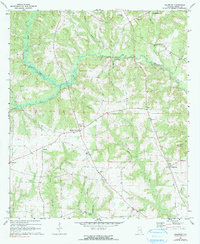
1970 Map of Haleburg
USGS Topo · Published 1991About this map
Abbie Creek and its many tributaries, including Peterman Creek and Geneva Creek, define the landscape of eastern Henry County during the late 20th century. This area is characterized by a network of small agricultural settlements and crossroads communities like Hardwickburg and Browns Crossroad, which are anchored by local religious and civic centers. Numerous country churches, such as Union Ch, Adoniram Ch, and Mt Pleasant Ch, serve as the primary landmarks for rural life. Genealogists may find value in the presence of several family or community burial grounds, including Balkum Cem and Culpepper Cem. The map provides a detailed view of the regional road network connecting the town of Haleburg to outlying areas like Tumbleton and Saunders, showing the distribution of homesteads and farmsteads along the winding branches of Foster Creek and Sandy Creek.
Find a feature on this map
35 named features on this map. Tap any name to fly to it.
Don’t see what you’re looking for? This feature index may not catch every label — zoom into the map to look around manually.
Map Details
Editions of this 1970 Haleburg Map
2 editions found
Other maps of this area

1953 · Dothan
USGS Topo · 1:250,000

1954 · Dothan
USGS Topo · 1:250,000

1955 · Dothan
USGS Topo · 1:250,000

1969 · Abbeville West
USGS Topo · 1:24,000

1969 · Fort Gaines
USGS Topo · 1:24,000

1969 · Headland
USGS Topo · 1:24,000

1969 · Abbeville East
USGS Topo · 1:24,000

1969 · Newville
USGS Topo · 1:24,000

1970 · Columbia NE
USGS Topo · 1:24,000

1970 · Haleburg
USGS Topo · 1:24,000