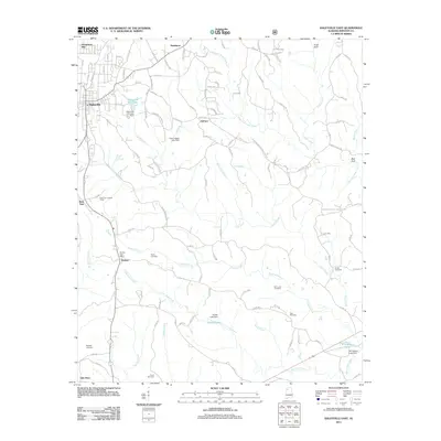
2011 Map of Haleyville East
USGS Topo · Published 2011About this map
Haleyville anchors the northwestern corner of this map, where the terrain begins to drop toward the headwaters of the Buttahatchee River. This part of Winston County is characterized by a high concentration of family-named landmarks and small crossroads communities such as Donaldson Mill, DeFoor, and Needmore. The hydrological network is well-defined by the Right Fork Clear Creek and Little Clear Creek, which feed into various impoundments like Elliotts Lake and W K Wilson Lake.
Find a feature on this map
112 named features on this map. Tap any name to fly to it.
Don’t see what you’re looking for? This feature index may not catch every label — zoom into the map to look around manually.
Map Details
Editions of this 2011 Haleyville East Map
This is the sole edition of this map. No revisions or reprints were ever made.
Other maps of this area

1936 · Delmar
USGS Topo · 1:24,000

1936 · Kinlock Spring
USGS Topo · 1:24,000

1936 · Phil Campbell
USGS Topo · 1:24,000

1936 · Moulton
USGS Topo · 1:48,000

1936 · Goddard
USGS Topo · 1:24,000

1940 · Mt Hope
USGS Topo · 1:62,500

1946 · Phil Campbell
USGS Topo · 1:24,000

1947 · Phil Campbell
USGS Topo · 1:24,000

1947 · Kinlock Spring
USGS Topo · 1:24,000
1949 · Kinlock Spring
USGS Topo · 1:24,000