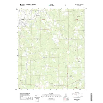
2021 Map of Haleyville East
USGS Topo · Published 2021About this map
Haleyville occupies the northwestern corner of this Winston County landscape, where the Tennessee Valley Divide marks the high ground above the William B. Bankhead National Forest. This modern survey reveals a countryside characterized by small settlements and numerous rural churches and family cemeteries, suggesting a deep-rooted social fabric tied to the land. From the community of Boar Tush in the west to DeFoor and Delmar, the map details the intricate network of county roads that link these points across the drainages of Clear Creek and Little Clear Creek. Notable landmarks for local historians include the Friendship Primitive Baptist Church and several small burial grounds like the Elliott Family Cem and Ayers Cem. The hydrology is defined by northern flows toward the Tennessee Valley and southern reaches like the Buttahatchee River, with larger bodies of water such as Haleyville City Lake and W K Wilson Lake punctuating the wooded terrain.
Find a feature on this map
125 named features on this map. Tap any name to fly to it.
Don’t see what you’re looking for? This feature index may not catch every label — zoom into the map to look around manually.
Map Details
Editions of this 2021 Haleyville East Map
This is the sole edition of this map. No revisions or reprints were ever made.
Other maps of this area

1936 · Delmar
USGS Topo · 1:24,000

1936 · Kinlock Spring
USGS Topo · 1:24,000

1936 · Phil Campbell
USGS Topo · 1:24,000

1936 · Moulton
USGS Topo · 1:48,000

1936 · Goddard
USGS Topo · 1:24,000

1940 · Mt Hope
USGS Topo · 1:62,500

1946 · Phil Campbell
USGS Topo · 1:24,000

1947 · Phil Campbell
USGS Topo · 1:24,000

1947 · Kinlock Spring
USGS Topo · 1:24,000
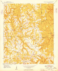
1949 · Kinlock Spring
USGS Topo · 1:24,000