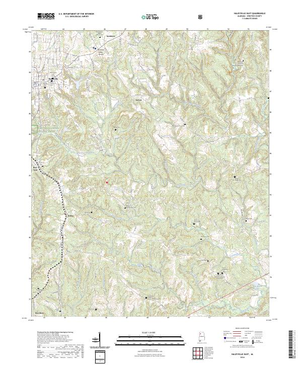
2024 Map of Haleyville East
USGS Topo · Published 2024About this map
Haleyville occupies the northwestern corner of this Winston County landscape, where urban streets like 9th Ave and Littleville Rd meet the edge of the William B. Bankhead National Forest. This 2024 survey documents a terrain defined by the Tennessee Valley Divide, with waters flowing into diverse drainages including the Buttahatchee River and Clear Creek. The map is particularly valuable for genealogical research, preserving the locations of numerous family and church burial grounds such as Elliott Family Cem, Old Lovett Cem, and the Bethel Number Two Cem. Rural life is centered around smaller settlements like Delmar, DeFoor, and the curiously named Boar Tush. Local industry and infrastructure are represented by features such as the Haleyville City Lake and Gravel Pit Rd, while the historical Byler Rd traces its way through the southern reaches near Glen Mary.
Find a feature on this map
85 named features on this map. Tap any name to fly to it.
Don’t see what you’re looking for? This feature index may not catch every label — zoom into the map to look around manually.
Map Details
Editions of this 2024 Haleyville East Map
This is the sole edition of this map. No revisions or reprints were ever made.
Other maps of this area

1936 · Delmar
USGS Topo · 1:24,000

1936 · Kinlock Spring
USGS Topo · 1:24,000

1936 · Phil Campbell
USGS Topo · 1:24,000

1936 · Moulton
USGS Topo · 1:48,000

1936 · Goddard
USGS Topo · 1:24,000

1940 · Mt Hope
USGS Topo · 1:62,500

1946 · Phil Campbell
USGS Topo · 1:24,000

1947 · Phil Campbell
USGS Topo · 1:24,000

1947 · Kinlock Spring
USGS Topo · 1:24,000
1949 · Kinlock Spring
USGS Topo · 1:24,000