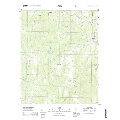
2018 Map of Haleyville West
USGS Topo · Published 2018About this map
The Tennessee Valley Divide cuts across this high-country landscape in Northwest Alabama, separating the headwaters of the Buttahatchee River from the northern drainage systems. This 2018 survey reveals the dispersed rural settlement pattern of the Haleyville area, where small clusters like Goddard and Bear Creek dot the landscape. A high concentration of family-named burial sites, including Trinity Cem, Old Ireland Cem, and Thornhill Cem, indicates generations of local kinship ties within the Marion and Winston county line region. The eastern edge of the map encompasses a portion of the William B. Bankhead National Forest, contrasting protected woodlands with the developed corridors of South Haleyville. Waterways such as the W Br Buttahatchee River and Kelly Mill Cr carve through the terrain, defining the local geography alongside historical roads like Alabama Ave and the legacy of the Byler Ave.
Find a feature on this map
111 named features on this map. Tap any name to fly to it.
Don’t see what you’re looking for? This feature index may not catch every label — zoom into the map to look around manually.
Map Details
Editions of this 2018 Haleyville West Map
This is the sole edition of this map. No revisions or reprints were ever made.
Other maps of this area

1936 · Delmar
USGS Topo · 1:24,000

1936 · Kinlock Spring
USGS Topo · 1:24,000

1936 · Phil Campbell
USGS Topo · 1:24,000

1936 · South Of Hackleburg
USGS Topo · 1:24,000

1936 · Hackleburg
USGS Topo · 1:24,000

1936 · Goddard
USGS Topo · 1:24,000

1946 · Hackleburg
USGS Topo · 1:24,000

1946 · Phil Campbell
USGS Topo · 1:24,000

1947 · Phil Campbell
USGS Topo · 1:24,000

1947 · Kinlock Spring
USGS Topo · 1:24,000