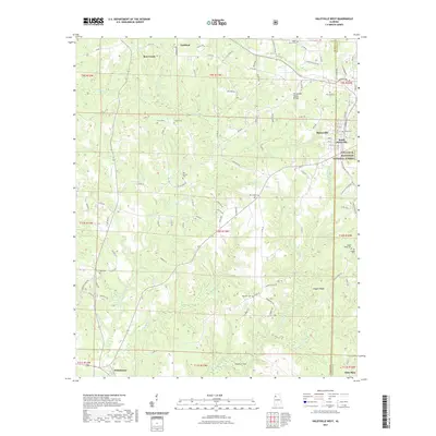
2021 Map of Haleyville West
USGS Topo · Published 2021About this map
Haleyville and South Haleyville sit at the eastern edge of a landscape defined by the Tennessee Valley Divide, where water flows toward either the Tennessee River or the Gulf of Mexico. This topographic study documents the western outskirts of these communities as they border the William B. Bankhead National Forest. The map is particularly rich for genealogical research, identifying numerous family and community burial grounds such as Union Grove Cem, Ireland Cem, and Thornhill Cem.
Find a feature on this map
110 named features on this map. Tap any name to fly to it.
Don’t see what you’re looking for? This feature index may not catch every label — zoom into the map to look around manually.
Map Details
Editions of this 2021 Haleyville West Map
This is the sole edition of this map. No revisions or reprints were ever made.
Other maps of this area

1936 · Delmar
USGS Topo · 1:24,000

1936 · Kinlock Spring
USGS Topo · 1:24,000

1936 · Phil Campbell
USGS Topo · 1:24,000

1936 · South Of Hackleburg
USGS Topo · 1:24,000

1936 · Hackleburg
USGS Topo · 1:24,000

1936 · Goddard
USGS Topo · 1:24,000

1946 · Hackleburg
USGS Topo · 1:24,000

1946 · Phil Campbell
USGS Topo · 1:24,000

1947 · Phil Campbell
USGS Topo · 1:24,000

1947 · Kinlock Spring
USGS Topo · 1:24,000