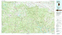
1980 Map of Haleyville
USGS Topo · Published 1983About this map
William B Bankhead National Forest dominates the heart of this landscape, a massive expanse of protected woodlands that separates the agricultural Tennessee Valley to the north from the river systems of the south. This 1980 survey captures a region defined by its topography, where the rising elevations of Brindley Mountain meet the Moulton Valley. The infrastructure of the era is anchored by the Illinois Central Gulf and Southern railroads, which connected established hubs like Haleyville and Russellville to the wider industrial corridor of Northwest Alabama.
Find a feature on this map
63 named features on this map. Tap any name to fly to it.
Don’t see what you’re looking for? This feature index may not catch every label — zoom into the map to look around manually.
Map Details
Editions of this 1980 Haleyville Map
This is the sole edition of this map. No revisions or reprints were ever made.
Other maps of this area

1888 · Cullman
USGS Topo · 1:125,000

1888 · Huntsville
USGS Topo · 1:125,000

1889 · Birmingham
USGS Topo · 1:125,000

1892 · Cullman
USGS Topo · 1:125,000

1892 · Birmingham
USGS Topo · 1:125,000

1892 · Huntsville
USGS Topo · 1:125,000

1893 · Jasper
USGS Topo · 1:125,000

1895 · Birmingham
USGS Topo · 1:125,000

1907 · Birmingham
USGS Topo · 1:125,000

1924 · Tuscumbia
USGS Topo · 1:48,000