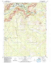
1990 Map of Half Dome
USGS Topo · Published 1991About this map
Half Dome stands as the centerpiece of this topographic study, anchoring the high sierra landscape above the Merced River. In the valley floor, the development of visitor services is well-established by the early 1990s, centered around Yosemite Village, Curry Village, and the Ahwahnee Hotel. The map documents the intricate infrastructure of the park, from the historic Chapel to the network of bridges like the Stoneman Bridge and Happy Isles Bridge. Beyond the valley walls, the terrain transitions into the Yosemite Wilderness, where a vast network of trails—including the John Muir Trail, Mist Trail, and Pohono Trail—links landmarks such as Glacier Point and Sentinel Dome. The inclusion of various facilities like Sunnyside Campground, the Nature Center, and the remote Ski Hut near Ostrander Lake illustrates the dual nature of the park as both a developed destination and a protected wilderness area.
Find a feature on this map
98 named features on this map. Tap any name to fly to it.
Don’t see what you’re looking for? This feature index may not catch every label — zoom into the map to look around manually.
Map Details
Editions of this 1990 Half Dome Map
2 editions found
Other maps of this area

1897 · Yosemite
USGS Topo · 1:125,000

1900 · Yosemite
USGS Topo · 1:125,000

1901 · Mt. Lyell
USGS Topo · 1:125,000

1903 · Yosemite
USGS Topo · 1:125,000

1909 · Yosemite
USGS Topo · 1:125,000

1947 · Mariposa
USGS Topo · 1:250,000

1948 · Mariposa
USGS Topo · 1:250,000

1953 · Merced Peak
USGS Topo · 1:62,500

1956 · Hetch Hetchy Reservoir
USGS Topo · 1:62,500

1956 · Tuolumne Meadows
USGS Topo · 1:62,500