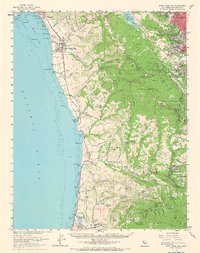
1961 Map of Half Moon Bay
USGS Topo · Published 1967About this map
The coastal fog belt of San Mateo County is preserved in this 1961 survey, revealing a landscape where agricultural traditions met emerging suburbanization. The Pacific coastline is marked by a series of beaches from Miramar Beach down to Pescadero Beach, while the interior is defined by deep canyons like Higgins Canyon and Purisima Creek. The map documents the early infrastructure of the San Francisco Peninsula, including the Upper Crystal Springs Reservoir and the San Francisco State Fish and Game Refuge.
Find a feature on this map
186 named features on this map. Tap any name to fly to it.
Don’t see what you’re looking for? This feature index may not catch every label — zoom into the map to look around manually.
Map Details
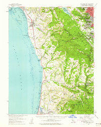
Editions of this 1961 Half Moon Bay Map
2 editions found
Other maps of this area

1892 · San Mateo
USGS Topo · 1:62,500

1896 · San Mateo
USGS Topo · 1:62,500

1897 · Palo Alto
USGS Topo · 1:62,500

1899 · Palo Alto
USGS Topo · 1:62,500

1899 · Haywards
USGS Topo · 1:62,500

1899 · San Mateo
USGS Topo · 1:62,500

1902 · Santa Cruz
USGS Topo · 1:125,000

1915 · San Mateo
USGS Topo · 1:62,500

1915 · Haywards
USGS Topo · 1:62,500

1939 · San Mateo
USGS Topo · 1:62,500