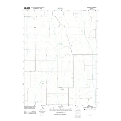
2012 Map of Half Rock
USGS Topo · Published 2012About this map
Half Rock and the small settlement of Topsy anchor this agricultural landscape in Mercer County, where local life follows the drainages of several north-south watercourses. The map traces the winding paths of West Honey Creek, East Honey Creek, and the curiously named Big No Creek and Little No Creek. This area is particularly rich for genealogical research, documenting several distinct burial sites including Brantley Cemetery in the north and Half Rock Cemetery and White Oak Cemetery to the south. The rural road network, featuring routes like Hazel Rd and CO Hwy-254, connects isolated homesteads and local landmarks such as Hammond Brothers Lake. The drainage patterns toward Little Medicine Creek define the eastern edge of the quadrangle, illustrating the land's gentle dissection by these persistent prairie streams.
Find a feature on this map
56 named features on this map. Tap any name to fly to it.
Don’t see what you’re looking for? This feature index may not catch every label — zoom into the map to look around manually.
Map Details
Editions of this 2012 Half Rock Map
This is the sole edition of this map. No revisions or reprints were ever made.
Other maps of this area

1946 · Princeton
USGS Topo · 1:62,500

1946 · Galt
USGS Topo · 1:62,500

1948 · Princeton
USGS Topo · 1:62,500

1948 · Trenton
USGS Topo · 1:62,500

1949 · Galt
USGS Topo · 1:62,500

1954 · Centerville
USGS Topo · 1:250,000

1957 · Centerville
USGS Topo · 1:250,000

1958 · Centerville
USGS Topo · 1:250,000

1964 · Ravanna
USGS Topo · 1:24,000

1964 · Harris
USGS Topo · 1:24,000