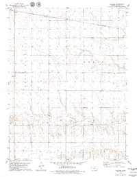
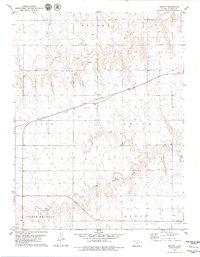
1979 Map of Halford
USGS Topo · Published 1979About this map
Halford serves as a key rail point in Thomas County, situated at the intersection of the Union Pacific railroad and Highway 83. This late 1970s landscape is defined by the expansive agricultural and industrial operations typical of the High Plains, including a large Feedlot and a Gravel Pit near the riverbanks. The natural drainage of the region is dominated by the South Fork Solomon River and Sand Creek, which carve distinct paths through the townships of North, Randall, and South Randall. The map illustrates the transition from traditional prairie land to modern industrial farming, with carefully surveyed sections and topographic relief highlighting the gentle but persistent flow of the High Plains river systems.
Find a feature on this map
10 named features on this map. Tap any name to fly to it.
Don’t see what you’re looking for? This feature index may not catch every label — zoom into the map to look around manually.
Map Details
Editions of this 1979 Halford Map
This is the sole edition of this map. No revisions or reprints were ever made.
Other maps of this area

1954 · Goodland
USGS Topo · 1:250,000

1956 · Goodland
USGS Topo · 1:250,000

1957 · Goodland
USGS Topo · 1:250,000

1979 · Menlo
USGS Topo · 1:24,000

1979 · Rexford
USGS Topo · 1:24,000
1979 · Mingo
USGS Topo · 1:24,000

1979 · Oakley North
USGS Topo · 1:24,000
1979 · Gem
USGS Topo · 1:24,000
1979 · Spica
USGS Topo · 1:24,000
1979 · Breton
USGS Topo · 1:24,000