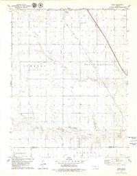
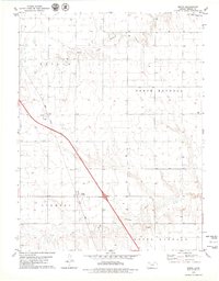
1979 Map of Spica
USGS Topo · Published 1979About this map
The North Fork Saline River and South Fork Saline River converge in this High Plains landscape, shaping the development of Thomas and Logan counties in the late 1970s. The small settlement of Spica sits at a geographic crossroads between the townships of Summers, South Randall, Monument, and Oakley. This era was defined by a transition toward intensive agricultural and energy production, evidenced by the presence of a large Feedlot and an established Oil Field. Transportation and logistics remain central to the region's character, with the Union Pacific railroad and Interstate 70 cutting through the prairie. Industrial activity is further highlighted by several Gravel Pits distributed across the river valley, while the boundary between Thomas County and Logan County marks the southern portion of the quadrangle.
Find a feature on this map
13 named features on this map. Tap any name to fly to it.
Don’t see what you’re looking for? This feature index may not catch every label — zoom into the map to look around manually.
Map Details
Editions of this 1979 Spica Map
2 editions found
Other maps of this area

1943 · Colby
USGS Topo · 1:62,500

1954 · Goodland
USGS Topo · 1:250,000

1956 · Goodland
USGS Topo · 1:250,000

1957 · Goodland
USGS Topo · 1:250,000

1967 · Colby SE
USGS Topo · 1:24,000

1972 · Monument
USGS Topo · 1:24,000

1972 · Winona NE
USGS Topo · 1:24,000
1979 · Oakley SW
USGS Topo · 1:24,000
1979 · Oakley South
USGS Topo · 1:24,000
1979 · Mingo
USGS Topo · 1:24,000