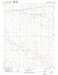
1979 Map of Oakley SW
USGS Topo · Published 1979About this map
Union Pacific rails cut across the northern reaches of Logan County in the late 1970s, tracing a path through the high plains of western Kansas. This landscape is defined by the drainage network of Hackberry Creek, which splits into the North Branch Hackberry Creek, Middle Branch Hackberry Creek, and South Branch Hackberry Creek. The terrain is marked by industrial activity typical of the High Plains, including a substantial Oil Field and several extraction sites like Gravel Pits and a smaller Gravel Pit. The map captures a moment of transition where the vast ranching and agricultural lands are overlaid with the infrastructure of energy and transport, including a major Pipeline running north to south. These features illustrate the economic reliance on both the natural watercourses and the underground resources that shaped this section of the Kansas plains.
Find a feature on this map
12 named features on this map. Tap any name to fly to it.
Don’t see what you’re looking for? This feature index may not catch every label — zoom into the map to look around manually.
Map Details
Editions of this 1979 Oakley SW Map
This is the sole edition of this map. No revisions or reprints were ever made.
Other maps of this area

1954 · Goodland
USGS Topo · 1:250,000

1955 · Scott City
USGS Topo · 1:250,000

1956 · Goodland
USGS Topo · 1:250,000

1957 · Goodland
USGS Topo · 1:250,000

1958 · Scott City
USGS Topo · 1:250,000

1972 · Monument
USGS Topo · 1:24,000

1972 · Winona NE
USGS Topo · 1:24,000

1972 · Elkader NW
USGS Topo · 1:24,000

1972 · Elkader NE
USGS Topo · 1:24,000
1972 · Russell Springs NE
USGS Topo · 1:24,000