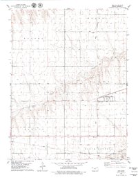
1979 Map of Gem
USGS Topo · Published 1979About this map
Gem serves as a central hub in this High Plains landscape, situated along the Chicago Rock Island and Pacific railroad line. The settlement is anchored by a local Township Cem, while the surrounding terrain is organized into distinct namesake regions such as Wendell, Lacey, and Morgan. These divisions reflect the systematic land use patterns of Thomas County, where agriculture and infrastructure dominate the flat expanse.
Find a feature on this map
14 named features on this map. Tap any name to fly to it.
Don’t see what you’re looking for? This feature index may not catch every label — zoom into the map to look around manually.
Map Details
Editions of this 1979 Gem Map
This is the sole edition of this map. No revisions or reprints were ever made.
Other maps of this area

1943 · Colby
USGS Topo · 1:62,500

1951 · Achilles
USGS Topo · 1:62,500

1951 · Chardon
USGS Topo · 1:62,500

1954 · Goodland
USGS Topo · 1:250,000

1956 · Goodland
USGS Topo · 1:250,000

1957 · Goodland
USGS Topo · 1:250,000

1967 · Colby SE
USGS Topo · 1:24,000

1967 · Colby
USGS Topo · 1:24,000

1978 · Long Draw South
USGS Topo · 1:24,000

1978 · Achilles SE
USGS Topo · 1:24,000