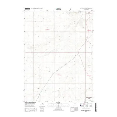
2015 Map of Halfway Hollow West
USGS Topo · Published 2015About this map
Ashley National Forest lands dominate the eastern and southern edges of this high-desert landscape in Sweetwater County. The terrain is defined by a network of seasonal drainages, most notably the winding paths of Big Dry Cr and Little Dry Cr, which cut through the arid plains toward the Flaming Gorge area. Transportation across this portion of the Green River Basin is facilitated by WY 530 and the diagonal route of Mckinnon Rd, which intersects with CR 1. The map also captures the distinct depression of Halfway Hollow, a localized landform that serves as a geographic anchor for the region. To the far south, the drainage of Buckboard Wash indicates the gradual shift in topography toward the reservoir systems of the Wyoming-Utah borderlands.
Find a feature on this map
14 named features on this map. Tap any name to fly to it.
Don’t see what you’re looking for? This feature index may not catch every label — zoom into the map to look around manually.
Map Details
Editions of this 2015 Halfway Hollow West Map
This is the sole edition of this map. No revisions or reprints were ever made.
Other maps of this area

1954 · Rock Springs
USGS Topo · 1:250,000

1957 · Mc Kinnon Junction
USGS Topo · 1:62,500

1958 · Rock Springs
USGS Topo · 1:250,000

1962 · Rock Springs
USGS Topo · 1:250,000

1964 · Antelope Knoll NE
USGS Topo · 1:24,000

1964 · Black Spring Reservoir
USGS Topo · 1:24,000

1964 · Winter Fat Reservoir
USGS Topo · 1:24,000

1966 · Mc Kinnon Junction
USGS Topo · 1:62,500

1966 · Buckboard Crossing
USGS Topo · 1:62,500
1980 · Firehole Canyon
USGS Topo · 1:100,000