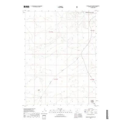
2017 Map of Halfway Hollow West
USGS Topo · Published 2017About this map
Ashley National Forest lands extend into the northeastern and southeastern corners of this high-desert landscape in Sweetwater County. The terrain is defined by the broad depression of Halfway Hollow, where seasonal watercourses like Big Dry Cr and Little Dry Cr carve through the arid plateau. This 2017 survey illustrates a modern remote interior, dominated by the administrative grid of the Public Land Survey System and the path of McKinnon Rd as it traverses the western sections. The drainage patterns of Buckboard Wash reveal the typical hydrologic structure of the Green River Basin, where intermittent streams remain the primary geographic markers across several townships.
Find a feature on this map
10 named features on this map. Tap any name to fly to it.
Don’t see what you’re looking for? This feature index may not catch every label — zoom into the map to look around manually.
Map Details
Editions of this 2017 Halfway Hollow West Map
This is the sole edition of this map. No revisions or reprints were ever made.
Other maps of this area

1954 · Rock Springs
USGS Topo · 1:250,000

1957 · Mc Kinnon Junction
USGS Topo · 1:62,500

1958 · Rock Springs
USGS Topo · 1:250,000

1962 · Rock Springs
USGS Topo · 1:250,000

1964 · Antelope Knoll NE
USGS Topo · 1:24,000

1964 · Black Spring Reservoir
USGS Topo · 1:24,000

1964 · Winter Fat Reservoir
USGS Topo · 1:24,000

1966 · Mc Kinnon Junction
USGS Topo · 1:62,500

1966 · Buckboard Crossing
USGS Topo · 1:62,500
1980 · Firehole Canyon
USGS Topo · 1:100,000