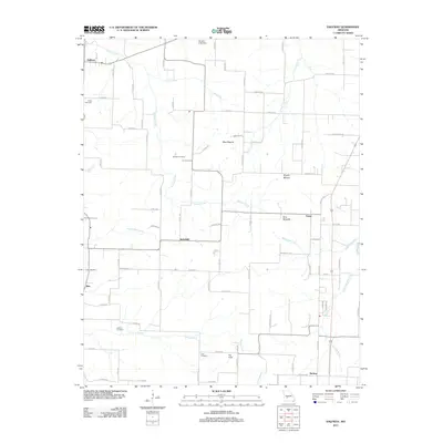
2011 Map of Halfway
USGS Topo · Published 2011About this map
Hominy Creek and Coon Creek carve through this section of Polk County, defining a landscape of agricultural plateaus and timbered drainages. Small settlements like Halfway and Schofield anchor the rural road network, while the crossroad at Foose sits near the distinctive Blue Mounds and Brushy Mound landforms. This 2011 survey captures the area's long-standing community structure, evidenced by a high density of family-named burial grounds. Genealogists can locate several historic sites including Reed Cemetery in the northwest and Ankrom Cemetery near Schultz Creek. In the south, the village of Redtop and the Pig Field terrain feature sit among the headwaters of Prater Branch, showing the persistent rural character of the region as it appeared in the early 21st century.
Find a feature on this map
76 named features on this map. Tap any name to fly to it.
Don’t see what you’re looking for? This feature index may not catch every label — zoom into the map to look around manually.
Map Details
Editions of this 2011 Halfway Map
This is the sole edition of this map. No revisions or reprints were ever made.
Other maps of this area

1884 · Springfield
USGS Topo · 1:125,000

1884 · Bolivar
USGS Topo · 1:125,000

1886 · Springfield
USGS Topo · 1:125,000

1892 · Bolivar
USGS Topo · 1:125,000

1947 · Strafford
USGS Topo · 1:62,500

1948 · Strafford
USGS Topo · 1:62,500

1950 · Buffalo NW
USGS Topo · 1:24,000

1950 · Polk
USGS Topo · 1:24,000

1951 · Buffalo NW
USGS Topo · 1:24,000

1951 · Polk
USGS Topo · 1:24,000