
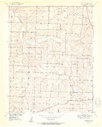
1951 Map of Buffalo NW
USGS Topo · Published 1951About this map
Rural township life along the Polk and Dallas county line is captured here through a network of mid-century country schools and small churches. The terrain is defined by the winding course of Lindley Creek and its many tributaries, which carve through the land to create a distinct pattern of small farmsteads and ridges. Local community centers are prominent, including Reynolds Chapel and several namesake schools such as Concord Sch and Brush Creek Sch. The map reveals a high density of one-room schoolhouses for this era, suggesting a landscape of tightly knit agrarian neighborhoods before district consolidation. Family history is preserved in small burial grounds like Breshears Cem and Redgate Cem, which remain anchored to the hillsides near Jordan Creek and Homing Creek.
Find a feature on this map
20 named features on this map. Tap any name to fly to it.
Don’t see what you’re looking for? This feature index may not catch every label — zoom into the map to look around manually.
Map Details
Editions of this 1951 Buffalo NW Map
2 editions found
Other maps of this area

1884 · Bolivar
USGS Topo · 1:125,000

1892 · Bolivar
USGS Topo · 1:125,000

1949 · Sentinel
USGS Topo · 1:24,000

1950 · Sentinel
USGS Topo · 1:24,000

1950 · Buffalo NW
USGS Topo · 1:24,000

1950 · Polk
USGS Topo · 1:24,000

1950 · Urbana
USGS Topo · 1:24,000

1951 · Urbana
USGS Topo · 1:24,000

1951 · Polk
USGS Topo · 1:24,000
1951 · Hermitage
USGS Topo · 1:62,500