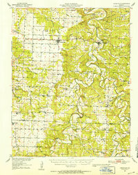
1951 Map of Hermitage
USGS Topo · Published 1952About this map
Pomme de Terre River and Lindley Creek carve a winding course through the landscape of the Ozarks, defining the development of rural settlements like Hermitage and Wheatland. This mid-century record by Edward L. Clark captures a region dominated by a dense network of country schools and churches, such as Elkton Sch and Macedonia Ch, reflecting a traditional agricultural society before the widespread consolidation of rural districts. The map documents unique natural and industrial features including Siphon Cave, Blackwell Cave, and the Peterson Mine. Families of the era can be traced through numerous burial grounds like Sumner Cem and McCracken Cem. The southern portion of the sheet marks the Hickory and Polk County line, where the terrain shifts toward Prairie lands near the ST Louis - San Francisco railroad tracks at Flemington.
Find a feature on this map
85 named features on this map. Tap any name to fly to it.
Don’t see what you’re looking for? This feature index may not catch every label — zoom into the map to look around manually.
Map Details
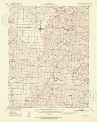
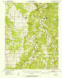
Editions of this 1951 Hermitage Map
3 editions found
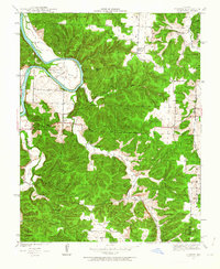
Other maps of this area

1884 · Bolivar
USGS Topo · 1:125,000

1886 · Stockton
USGS Topo · 1:125,000

1887 · Clinton
USGS Topo · 1:125,000

1887 · Warsaw
USGS Topo · 1:125,000

1892 · Bolivar
USGS Topo · 1:125,000

1894 · Warsaw
USGS Topo · 1:125,000

1894 · Clinton
USGS Topo · 1:125,000

1940 · Weaubleau
USGS Topo · 1:24,000
1940 · Iconium
USGS Topo · 1:24,000

1942 · Elkton
USGS Topo · 1:24,000