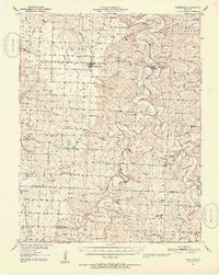
1951 Map of Hermitage
USGS Topo · Published 1954About this map
The Pomme de Terre River winds through this mid-century Missouri landscape, carving a deep valley that defines the local geography. At the heart of the region, the county seat of Hermitage sits on the river's eastern banks, while Wheatland occupies the prairie to the west. This period before major reservoir development reveals the original river course and its many bends, such as Nigger Bend and Dooley Bend, and the crossings that served local farmers, including Ingalls Ford.
Find a feature on this map
86 named features on this map. Tap any name to fly to it.
Don’t see what you’re looking for? This feature index may not catch every label — zoom into the map to look around manually.
Map Details
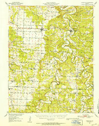
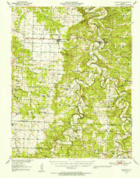
Editions of this 1951 Hermitage Map
3 editions found
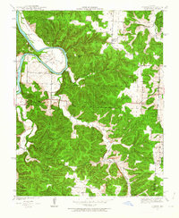
Other maps of this area

1884 · Bolivar
USGS Topo · 1:125,000

1886 · Stockton
USGS Topo · 1:125,000

1887 · Clinton
USGS Topo · 1:125,000

1887 · Warsaw
USGS Topo · 1:125,000

1892 · Bolivar
USGS Topo · 1:125,000

1894 · Warsaw
USGS Topo · 1:125,000

1894 · Clinton
USGS Topo · 1:125,000

1940 · Weaubleau
USGS Topo · 1:24,000
1940 · Iconium
USGS Topo · 1:24,000

1942 · Elkton
USGS Topo · 1:24,000