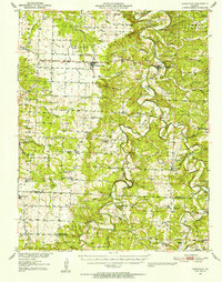
1951 Map of Hermitage
USGS Topo · Published 1964About this map
The Pomme de Terre River and Lindley Creek carve deep, meandering paths through this portion of Missouri, defining the landscape just before the completion of major reservoir projects. The central settlement of Hermitage sits at a strategic bend in the river, serving as a hub for the surrounding rural townships of Wheatland, Center, and Stark. The map reveals a dense network of country schools and family burial grounds, such as Elkton Sch, Salem Sch, and the McCracken Cem, indicating a well-established agrarian community of the mid-century.
Find a feature on this map
96 named features on this map. Tap any name to fly to it.
Don’t see what you’re looking for? This feature index may not catch every label — zoom into the map to look around manually.
Map Details
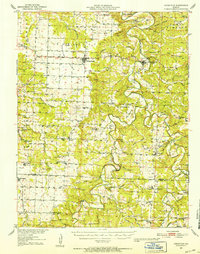
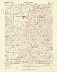
Editions of this 1951 Hermitage Map
3 editions found
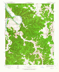
Other maps of this area

1884 · Bolivar
USGS Topo · 1:125,000

1886 · Stockton
USGS Topo · 1:125,000

1887 · Clinton
USGS Topo · 1:125,000

1887 · Warsaw
USGS Topo · 1:125,000

1892 · Bolivar
USGS Topo · 1:125,000

1894 · Warsaw
USGS Topo · 1:125,000

1894 · Clinton
USGS Topo · 1:125,000

1940 · Weaubleau
USGS Topo · 1:24,000
1940 · Iconium
USGS Topo · 1:24,000

1942 · Elkton
USGS Topo · 1:24,000