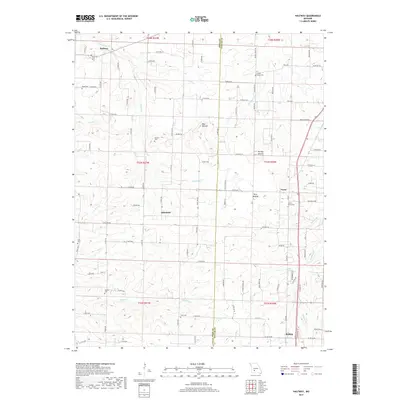
2017 Map of Halfway
USGS Topo · Published 2017About this map
Halfway and the surrounding rural landscape of the Polk and Dallas county line are captured in this detail-rich survey. The terrain is defined by prominent rises like Blue Mound and Brushy Mound, which stand above a network of small watercourses including Hominy Cr and Schultz Cr. The settlement pattern follows a grid of township and range lines, with small communities such as Schofield, Foose, and Redtop serving as local anchors. Family history is well-preserved through numerous rural burial grounds, including the Reed Cem, Ankrom Cem, and Viles Cem, often located near crossroads or along the county boundary. The map illustrates a predominantly agricultural region where local transport depends on a dense system of numbered roads and secondary routes like State Hwy FF and State Hwy EE, connecting these isolated farmsteads and small crossroads settlements.
Find a feature on this map
101 named features on this map. Tap any name to fly to it.
Don’t see what you’re looking for? This feature index may not catch every label — zoom into the map to look around manually.
Map Details
Editions of this 2017 Halfway Map
This is the sole edition of this map. No revisions or reprints were ever made.
Other maps of this area

1884 · Springfield
USGS Topo · 1:125,000

1884 · Bolivar
USGS Topo · 1:125,000

1886 · Springfield
USGS Topo · 1:125,000

1892 · Bolivar
USGS Topo · 1:125,000

1947 · Strafford
USGS Topo · 1:62,500

1948 · Strafford
USGS Topo · 1:62,500

1950 · Buffalo NW
USGS Topo · 1:24,000

1950 · Polk
USGS Topo · 1:24,000

1951 · Buffalo NW
USGS Topo · 1:24,000

1951 · Polk
USGS Topo · 1:24,000