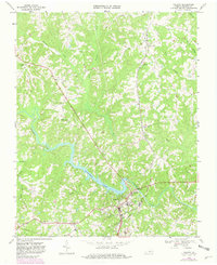
1968 Map of Halifax
USGS Topo · Published 1981About this map
Halifax serves as the focal point of this Virginia survey, situated at the bend where the Banister River meets the expansive waters of Banister Lake. The town's layout reflects a classic Southern courthouse seat character, defined by its connection to the Norfolk and Western railroad and the presence of significant local institutions like Bethune High Sch. The surrounding landscape is a network of ridges and watercourses, including the curiously named Terrible Creek and Little Terrible Creek to the north, and Polecat Cr to the west.
Find a feature on this map
31 named features on this map. Tap any name to fly to it.
Don’t see what you’re looking for? This feature index may not catch every label — zoom into the map to look around manually.
Map Details
Editions of this 1968 Halifax Map
Other maps of this area

1952 · Milton
USGS Topo · 1:62,500

1953 · South Boston
USGS Topo · 1:62,500

1953 · Greensboro
USGS Topo · 1:250,000

1954 · Greensboro
USGS Topo · 1:250,000

1954 · Halifax
USGS Topo · 1:62,500

1954 · Riceville
USGS Topo · 1:62,500

1956 · Milton
USGS Topo · 1:62,500

1957 · South Boston
USGS Topo · 1:62,500

1962 · Greensboro
USGS Topo · 1:250,000

1966 · Greensboro
USGS Topo · 1:250,000