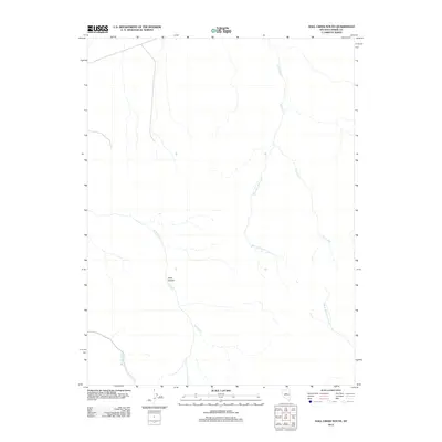
2012 Map of Hall Creek South
USGS Topo · Published 2012About this map
Iowa Canyon cuts through this high-desert portion of Lander County, serving as a primary topographic feature in a landscape defined by its drainages. The map reveals a complex network of seasonal and perennial waterways that have shaped the local geography, including the prominent Hall Creek and its tributary, West Fork Hall Creek. In the southwest, Boone Creek and Iowa Creek trace the lower elevations, while North Fork Skull Creek emerges in the southeast corner. This 2012 survey illustrates the hydrological patterns that have historically dictated movement and land use in this part of Nevada, where canyon corridors like Iowa Canyon provide the most accessible routes through the varying elevations of the basin and range province.
Find a feature on this map
6 named features on this map. Tap any name to fly to it.
Don’t see what you’re looking for? This feature index may not catch every label — zoom into the map to look around manually.
Map Details
Editions of this 2012 Hall Creek South Map
This is the sole edition of this map. No revisions or reprints were ever made.
Other maps of this area

1926 · Roberts Mountains
USGS Topo · 1:250,000

1929 · Roberts Mountains
USGS Topo · 1:250,000

1955 · Millett
USGS Topo · 1:250,000

1956 · Mount Callaghan
USGS Topo · 1:62,500

1956 · Hall Creek
USGS Topo · 1:62,500

1959 · Millett
USGS Topo · 1:250,000

1969 · Joe Eason Mtn
USGS Topo · 1:24,000

1969 · Vigus Butte NE
USGS Topo · 1:24,000
1969 · Manhattan Mtn NE
USGS Topo · 1:24,000

1979 · Simpson Park Mtns
USGS Topo · 1:100,000