
1969 Map of Joe Eason Mtn
USGS Topo · Published 1971About this map
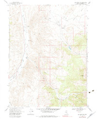
Reese River and its accompanying Old Railroad Grade define the western landscape of this central Nevada territory during the late 1960s. The valley floor is punctuated by small-scale ranching operations, including the Vaughn Ranch and Boone Creek Ranch, which relied on the intermittent drainages flowing from the higher elevations of Joe Eason Mtn. The presence of the Iowa Canyon Sch and the Iowa Canyon Ranch near the center of the quadrangle suggests a small, localized community hub centered around the Iowa Canyon drainage.
Find a feature on this map
24 named features on this map. Tap any name to fly to it.
Don’t see what you’re looking for? This feature index may not catch every label — zoom into the map to look around manually.
Map Details
Editions of this 1969 Joe Eason Mtn Map
2 editions found
Other maps of this area

1926 · Roberts Mountains
USGS Topo · 1:250,000

1929 · Roberts Mountains
USGS Topo · 1:250,000

1955 · Millett
USGS Topo · 1:250,000

1956 · Mount Callaghan
USGS Topo · 1:62,500

1956 · Hall Creek
USGS Topo · 1:62,500

1959 · Millett
USGS Topo · 1:250,000

1969 · Manhattan Mtn
USGS Topo · 1:24,000
1969 · Manhattan Mtn NW
USGS Topo · 1:24,000

1969 · Vigus Butte NE
USGS Topo · 1:24,000

1969 · Vigus Butte NW
USGS Topo · 1:24,000