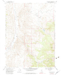
1969 Map of Joe Eason Mtn
USGS Topo · Published 1983About this map
Carico Lake Valley and the surrounding high desert terrain define this landscape as it was documented in the late 1960s. The western edge of the quadrangle is dominated by the Reese River floodplain, where the remnants of an Old Railroad Grade parallel the river through Duffy Meadows. This transport corridor once connected the remote ranches of Lander County to broader networks, evidenced by the clustered homesteads and infrastructure found further inland.
Find a feature on this map
24 named features on this map. Tap any name to fly to it.
Don’t see what you’re looking for? This feature index may not catch every label — zoom into the map to look around manually.
Map Details
Editions of this 1969 Joe Eason Mtn Map
2 editions found
Other maps of this area

1926 · Roberts Mountains
USGS Topo · 1:250,000

1929 · Roberts Mountains
USGS Topo · 1:250,000

1955 · Millett
USGS Topo · 1:250,000

1956 · Mount Callaghan
USGS Topo · 1:62,500

1956 · Hall Creek
USGS Topo · 1:62,500

1959 · Millett
USGS Topo · 1:250,000

1969 · Manhattan Mtn
USGS Topo · 1:24,000

1969 · Joe Eason Mtn
USGS Topo · 1:24,000
1969 · Manhattan Mtn NW
USGS Topo · 1:24,000

1969 · Vigus Butte NE
USGS Topo · 1:24,000