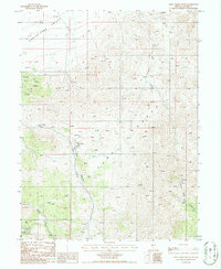
1986 Map of Hall Creek South
USGS Topo · Published 1986About this map
Shoshone Range high country and the arid transition into the Carico Lake Valley dominate this mid-1980s topographical study. The landscape is defined by its industrial mineral potential, characterized by numerous prospects and specialized operations like the Open Pit Iowa Canyon Mine. Water remains a critical element for both mining and survival in this environment, with significant drainages like Hall Creek and the North Fork Skull Creek providing geological definition. The concentration of an Open Pit and various prospect locations near Iowa Creek Canyon reveals the intensity of exploration in the region during this period. This map serves as a detailed record of high-desert geography before later modern developments, marking numerous natural Spring and Springs locations essential to the local ecosystem and historical land use.
Find a feature on this map
12 named features on this map. Tap any name to fly to it.
Don’t see what you’re looking for? This feature index may not catch every label — zoom into the map to look around manually.
Map Details
Editions of this 1986 Hall Creek South Map
This is the sole edition of this map. No revisions or reprints were ever made.
Other maps of this area

1926 · Roberts Mountains
USGS Topo · 1:250,000

1929 · Roberts Mountains
USGS Topo · 1:250,000

1955 · Millett
USGS Topo · 1:250,000

1956 · Mount Callaghan
USGS Topo · 1:62,500

1956 · Hall Creek
USGS Topo · 1:62,500

1959 · Millett
USGS Topo · 1:250,000

1969 · Joe Eason Mtn
USGS Topo · 1:24,000

1969 · Vigus Butte NE
USGS Topo · 1:24,000
1969 · Manhattan Mtn NE
USGS Topo · 1:24,000

1979 · Simpson Park Mtns
USGS Topo · 1:100,000