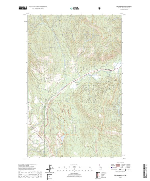
2024 Map of Hall Mountain
USGS Topo · Published 2024About this map
The Purcell Trench cuts a dramatic path through the northern Idaho landscape, framed by the high peaks of the Purcell Mountains. This area of the Kaniksu National Forest is defined by its drainage systems and access routes, where Mission Creek and Miller Creek flow toward the lower elevations of Round Prairie. The map illustrates a network of forestry roads and significant recreation corridors, most notably the Pacific Northwest National Scenic Trl, which traverses the high ground near Bethlehem Mtn. Smaller settlements like Deer Park and Round Prairie mark the lowlands, while landmarks like Tungsten Mtn and Hall Mtn dominate the horizon. Remote water bodies such as Brush Lake provide focal points for local geography in this part of Boundary County, situated along the path of historic transit routes like Old Hwy 95.
Find a feature on this map
33 named features on this map. Tap any name to fly to it.
Don’t see what you’re looking for? This feature index may not catch every label — zoom into the map to look around manually.
Map Details
Editions of this 2024 Hall Mountain Map
This is the sole edition of this map. No revisions or reprints were ever made.
Other maps of this area

1911 · Priest Lake
USGS Topo · 1:250,000

1913 · Priest Lake
USGS Topo · 1:250,000

1958 · Sandpoint
USGS Topo · 1:250,000

1963 · Sandpoint
USGS Topo · 1:250,000

1965 · Meadow Creek
USGS Topo · 1:24,000

1965 · Farnham Peak
USGS Topo · 1:24,000

1965 · Eastport
USGS Topo · 1:24,000

1965 · Ritz
USGS Topo · 1:24,000

1965 · Copeland
USGS Topo · 1:24,000

1965 · Hall Mountain
USGS Topo · 1:24,000