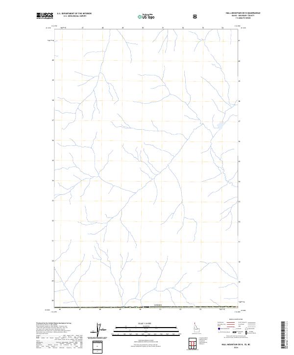
2024 Map of Hall Mountain OE N
USGS Topo · Published 2024About this map
The international border with Canada defines the northern reaches of this Idaho landscape in Boundary County. Surveyed by the U.S. Geological Survey, the map documents the drainage patterns and township divisions near the headwaters of several unnamed creek systems. The southern edge of the quadrangle is anchored by the township line of T 65 N R 1 E, marking a specific point in the Public Land Survey System. This area is characterized by its high-altitude watercourses and proximity to the Canadian frontier, where the geography remains largely undeveloped and focused on the natural hydrography of the region.
Find a feature on this map
2 named features on this map. Tap any name to fly to it.
Don’t see what you’re looking for? This feature index may not catch every label — zoom into the map to look around manually.
Map Details
Editions of this 2024 Hall Mountain OE N Map
This is the sole edition of this map. No revisions or reprints were ever made.
Other maps of this area

1911 · Priest Lake
USGS Topo · 1:250,000

1913 · Priest Lake
USGS Topo · 1:250,000

1958 · Sandpoint
USGS Topo · 1:250,000

1963 · Sandpoint
USGS Topo · 1:250,000

1965 · Eastport
USGS Topo · 1:24,000

1965 · Copeland
USGS Topo · 1:24,000

1965 · Hall Mountain
USGS Topo · 1:24,000
1983 · Bonners Ferry
USGS Topo · 1:100,000
1996 · Hall Mountain
USGS Topo · 1:24,000
1996 · Eastport
USGS Topo · 1:24,000