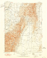
1935 Map of Halleck
USGS Topo · Published 1951About this map
Humboldt River and the parallel tracks of the Southern Pacific Railroad and Western Pacific Railroad dominate the northwestern lowlands of this Elko County survey. The landscape is defined by the dramatic meeting of the Lamoille Valley and the towering Ruby Mountains, where numerous high-altitude lakes like Verdi Lake and Favre Lake sit tucked below peaks such as Wines Pk. This era captures the transition of the Great Basin frontier, showing the site of Fort Halleck alongside active ranching operations at 71 Ranch and Starr Ranch. Industrial footprints are visible at the Lamoille-Elko Power Plant and scattered mining claims including the Polar Star Mine and American Beauty Mine. Small local schools like Valley View Sch and Panama Sch reflect a dispersed but established rural community centered around the Halleck and Lamoille settlements.
Find a feature on this map
115 named features on this map. Tap any name to fly to it.
Don’t see what you’re looking for? This feature index may not catch every label — zoom into the map to look around manually.
Map Details
Editions of this 1935 Halleck Map
3 editions found
Other maps of this area

1934 · Jiggs
USGS Topo · 1:125,000

1935 · Halleck
USGS Topo · 1:125,000

1937 · Jiggs
USGS Topo · 1:125,000

1953 · Spruce Mountain
USGS Topo · 1:62,500

1955 · Wells
USGS Topo · 1:250,000

1955 · Elko
USGS Topo · 1:250,000

1958 · Wells
USGS Topo · 1:250,000

1958 · Elko
USGS Topo · 1:250,000

1959 · Jiggs
USGS Topo · 1:62,500

1961 · Wells
USGS Topo · 1:250,000