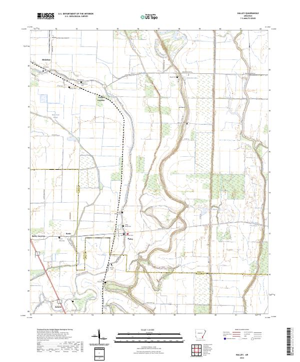
2024 Map of Halley
USGS Topo · Published 2024About this map
Crooked Bayou meanders across this alluvial landscape, defining the character of the southeastern Arkansas delta between McGehee and Halley. The map reveals a high concentration of burial sites and family landmarks, such as the Halley Family Cem and Old Grange Cem, which serve as vital markers for local genealogists. The terrain is crisscrossed by drainage networks and bayous, including Boggy Bayou and Black Pond Slough, reflecting the complex hydrology of the Mississippi Delta region.
Find a feature on this map
59 named features on this map. Tap any name to fly to it.
Don’t see what you’re looking for? This feature index may not catch every label — zoom into the map to look around manually.
Map Details
Editions of this 2024 Halley Map
This is the sole edition of this map. No revisions or reprints were ever made.
Other maps of this area

1933 · Lamont
USGS Topo · 1:62,500

1936 · McGehee
USGS Topo · 1:62,500

1936 · Lake Village
USGS Topo · 1:62,500

1937 · McGehee
USGS Topo · 1:62,500

1939 · Refuge
USGS Topo · 1:62,500

1939 · Lamont
USGS Topo · 1:62,500

1953 · Greenwood
USGS Topo · 1:250,000

1955 · Lake Village
USGS Topo · 1:62,500

1955 · McGehee
USGS Topo · 1:62,500

1956 · Greenwood
USGS Topo · 1:250,000