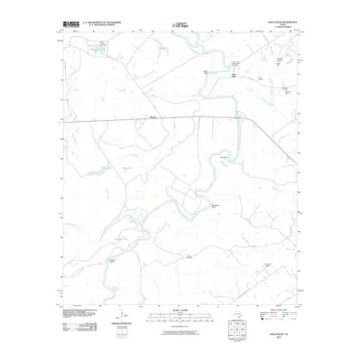
2010 Map of Halls Bluff
USGS Topo · Published 2010About this map
The Trinity River snakes through this East Texas landscape, defining a terrain of river bends and prominent elevations. Significant high points along the water include Yellow Bluff, Halls Bluff, and Brookfield Bluff, while the southern reaches feature Wiggins Bluff. These natural overlooks were vital for river navigation and early settlement, as evidenced by the Trinity River Loading and Landing located near Iron Bridge.
Find a feature on this map
43 named features on this map. Tap any name to fly to it.
Don’t see what you’re looking for? This feature index may not catch every label — zoom into the map to look around manually.
Map Details
Editions of this 2010 Halls Bluff Map
This is the sole edition of this map. No revisions or reprints were ever made.
Other maps of this area

1953 · Palestine
USGS Topo · 1:250,000

1957 · Palestine
USGS Topo · 1:250,000

1964 · Austonio
USGS Topo · 1:24,000

1964 · Porter Springs
USGS Topo · 1:24,000

1964 · Pearsons Chapel
USGS Topo · 1:24,000

1964 · Eunice
USGS Topo · 1:24,000

1964 · Middleton
USGS Topo · 1:24,000

1964 · Halls Bluff
USGS Topo · 1:24,000

1964 · Lake Leon
USGS Topo · 1:24,000

1964 · Hays Spring
USGS Topo · 1:24,000