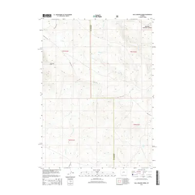
2015 Map of Halls Meadow Spring
USGS Topo · Published 2015About this map
The Continental Divide crests across this landscape, defining the high-altitude drainage systems of western Wyoming. The area serves as a critical historical corridor, most notably marked by the Lander Cutoff, a significant emigrant wagon trail that diverted from the main Oregon Trail to offer a more direct route westward. This 2015 survey illustrates how the trail's path remains etched into the topography, crossing the Sublette and Fremont county line.
Find a feature on this map
17 named features on this map. Tap any name to fly to it.
Don’t see what you’re looking for? This feature index may not catch every label — zoom into the map to look around manually.
Map Details
Editions of this 2015 Halls Meadow Spring Map
This is the sole edition of this map. No revisions or reprints were ever made.
Other maps of this area

1953 · Christina Lake
USGS Topo · 1:24,000

1955 · Lander
USGS Topo · 1:250,000

1958 · Lander
USGS Topo · 1:250,000

1958 · Parting of the Ways
USGS Topo · 1:62,500

1958 · Hay Meadow Reservoir
USGS Topo · 1:24,000

1958 · Pacific Springs
USGS Topo · 1:24,000

1958 · Parting of the Ways
USGS Topo · 1:24,000

1961 · Lander
USGS Topo · 1:250,000

1969 · Jensen Meadows
USGS Topo · 1:24,000
1969 · Sweetwater Needles
USGS Topo · 1:24,000