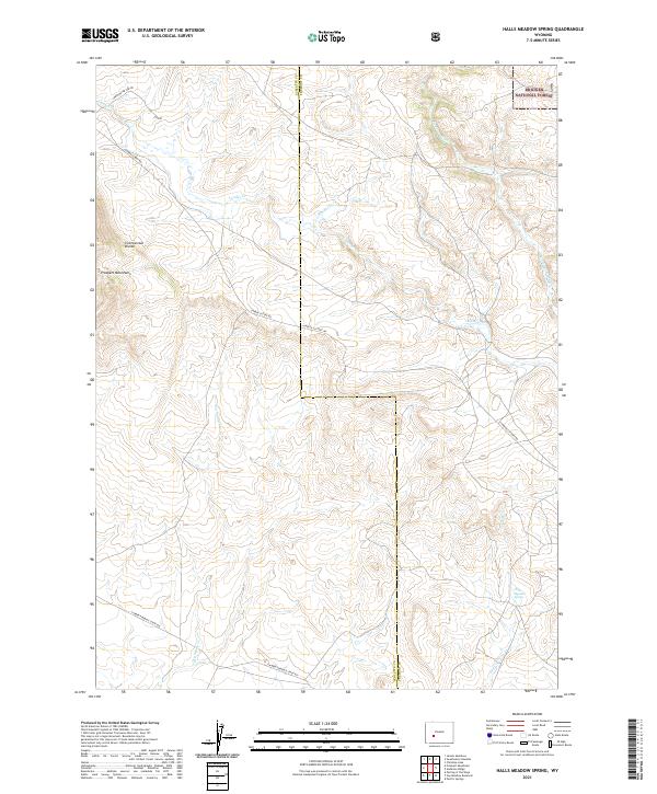
2021 Map of Halls Meadow Spring
USGS Topo · Published 2021About this map
The Continental Divide crests through this high-altitude landscape along the border of Sublette and Fremont counties. This area is defined by its historic transportation corridors, where the Lander Cutoff Rd and the Lander Pinedale Stage Rd cross the terrain, tracing routes essential to early westward expansion and regional ranching. The Prospect Mountains rise in the west, overlooking a network of headwaters including Lander Cr and the Sweetwater River. This modern survey captures a section of the Bridger National Forest where traditional livestock and wildlife watering points like Halls Meadow Spring remain vital landmarks. The drainage patterns of Blucher Cr and Dry Sandy Cr illustrate the complex hydrology of the western slope, where every creek and spring served as a critical waypoint for travelers navigating the high plains and mountain passes.
Find a feature on this map
17 named features on this map. Tap any name to fly to it.
Don’t see what you’re looking for? This feature index may not catch every label — zoom into the map to look around manually.
Map Details
Editions of this 2021 Halls Meadow Spring Map
This is the sole edition of this map. No revisions or reprints were ever made.
Other maps of this area

1953 · Christina Lake
USGS Topo · 1:24,000

1955 · Lander
USGS Topo · 1:250,000

1958 · Lander
USGS Topo · 1:250,000

1958 · Parting of the Ways
USGS Topo · 1:62,500

1958 · Hay Meadow Reservoir
USGS Topo · 1:24,000

1958 · Pacific Springs
USGS Topo · 1:24,000

1958 · Parting of the Ways
USGS Topo · 1:24,000

1961 · Lander
USGS Topo · 1:250,000

1969 · Jensen Meadows
USGS Topo · 1:24,000
1969 · Sweetwater Needles
USGS Topo · 1:24,000