
1940 Map of Hallton
USGS Topo · Published 1940About this map
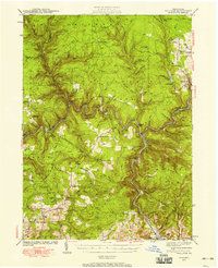
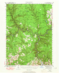
The Clarion River winds through this 1940 survey of the Pennsylvania wilds, carving deep valleys through the heart of the Allegheny National Forest. This era of the landscape is defined by the intersection of early conservation and industrial activity, featuring the Game Commission Training Sch and a visible CCC Camp alongside active timber and rail networks. Several small settlements such as Hallton, Portland Mills, and Arroyo are shown at their mid-century peak, linked by the Baltimore and Ohio Railroad and the Erie Railroad that trace the river banks.
Find a feature on this map
115 named features on this map. Tap any name to fly to it.
Don’t see what you’re looking for? This feature index may not catch every label — zoom into the map to look around manually.
Map Details
Editions of this 1940 Hallton Map
3 editions found
Other maps of this area

1918 · Loleta
USGS Topo · 1:62,500

1922 · Du Bois
USGS Topo · 1:62,500

1924 · Du Bois
USGS Topo · 1:62,500

1924 · Brookville
USGS Topo · 1:62,500

1926 · Brookville
USGS Topo · 1:62,500

1929 · Penfield
USGS Topo · 1:62,500

1932 · Penfield
USGS Topo · 1:62,500

1934 · Kane
USGS Topo · 1:48,000

1935 · Sheffield
USGS Topo · 1:48,000

1935 · Mt. Jewett
USGS Topo · 1:48,000
Featured Places
- Warsaw Township, PA
- Millstone Township, PA
- Polk Township, PA
- Lake City, Spring Creek Township
- Snyder Township, PA