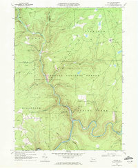
1969 Map of Hallton
USGS Topo · Published 1972About this map
The Clarion River winds deeply through the southern portion of this landscape, carving a sharp oxbow near the settlement of Hallton. This 1969 survey captures an area defined by the intersection of resource extraction and conservation, where the Spring Creek Gas Field and Hallton Gas Field overlay the wooded expanse of the Allegheny National Forest and multiple state game lands. The map details the remote character of Elk and Forest counties, showing isolated homesteads and religious sites like the unnamed Church and Cem near the river bend.
Find a feature on this map
46 named features on this map. Tap any name to fly to it.
Don’t see what you’re looking for? This feature index may not catch every label — zoom into the map to look around manually.
Map Details
Editions of this 1969 Hallton Map
2 editions found
Other maps of this area

1918 · Loleta
USGS Topo · 1:62,500

1934 · Kane
USGS Topo · 1:48,000

1935 · Sheffield
USGS Topo · 1:48,000

1936 · Marienville
USGS Topo · 1:48,000

1939 · Kane
USGS Topo · 1:62,500

1940 · Hallton
USGS Topo · 1:48,000

1941 · Sheffield
USGS Topo · 1:62,500

1941 · Marienville
USGS Topo · 1:62,500

1943 · Hallton
USGS Topo · 1:62,500

1957 · Warren
USGS Topo · 1:250,000
Featured Places
- Millstone Township, PA
- Jenks Township, PA
- Owls Nest, Highland Township
- Beuhler Corner, Spring Creek Township
- Arroyo, Spring Creek Township