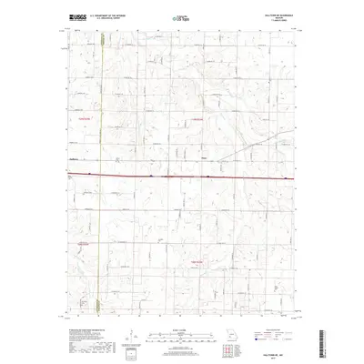
2017 Map of Halltown NE
USGS Topo · Published 2017About this map
The Sac River and its numerous tributaries, including Pickerel Cr and Sycamore Cr, define the drainage patterns across this section of Southwest Missouri. Small rural settlements like Halltown and Plano are connected by a network of farm-to-market roads that bridge the Lawrence and Greene County line. For family historians, the landscape is punctuated by several small burial sites, such as Batson Cem, Garoutte Cem, and the Ruckman Cem located near Turnback Creek. The map details the transition from the upper reaches of the Pond Cr watershed to the more prominent Sac River valley. This 2017 survey reflects the modern road designations, including State Hwy TT and Hwy Z, while preserving the locations of legacy family landmarks such as Squibb Cem and Wade Chapel Cem.
Find a feature on this map
92 named features on this map. Tap any name to fly to it.
Don’t see what you’re looking for? This feature index may not catch every label — zoom into the map to look around manually.
Map Details
Editions of this 2017 Halltown NE Map
This is the sole edition of this map. No revisions or reprints were ever made.
Other maps of this area

1884 · Springfield
USGS Topo · 1:125,000

1886 · Greenfield
USGS Topo · 1:125,000

1886 · Springfield
USGS Topo · 1:125,000

1888 · Greenfield
USGS Topo · 1:125,000

1919 · Halltown
USGS Topo · 1:62,500

1936 · Brookline
USGS Topo · 1:24,000

1948 · Willard
USGS Topo · 1:24,000

1954 · Springfield
USGS Topo · 1:250,000

1956 · Ash Grove
USGS Topo · 1:24,000
1956 · Everton
USGS Topo · 1:24,000