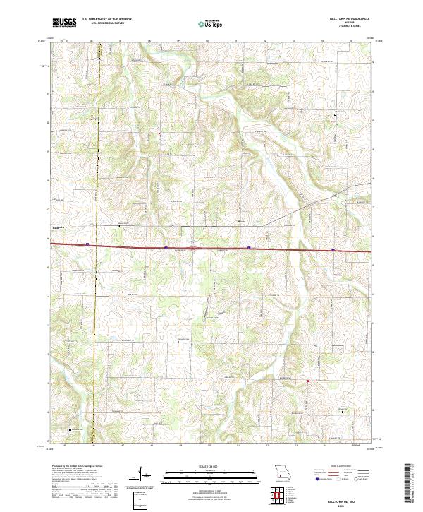
2021 Map of Halltown NE
USGS Topo · Published 2021About this map
The Sac River meanders across the northeast corner of this Greene County landscape, defining a terrain shaped by the tributaries of the Ozark Plateau. Between the small communities of Halltown and Plano, the land is etched by a dense network of waterways including Sycamore Cr, Pickerel Cr, and Turnback Creek. This map shows a rural region where family heritage is deeply rooted in the landscape, evidenced by the numerous small burial grounds scattered among the farm sections. These include Squibb Cem, Batson Cem, and Garoutte Cem, alongside the more isolated Ruckman Cem and Wade Chapel Cem. The transportation network is a rigorous grid of farm roads and county lines, such as Lawrence 2030 and W Farm Rd 124, reflecting the persistent agricultural character of the area into the twenty-first century. Aviation interests are represented by the modest Medcalf Field, situated south of the settlement at Plano.
Find a feature on this map
55 named features on this map. Tap any name to fly to it.
Don’t see what you’re looking for? This feature index may not catch every label — zoom into the map to look around manually.
Map Details
Editions of this 2021 Halltown NE Map
This is the sole edition of this map. No revisions or reprints were ever made.
Other maps of this area

1884 · Springfield
USGS Topo · 1:125,000

1886 · Greenfield
USGS Topo · 1:125,000

1886 · Springfield
USGS Topo · 1:125,000

1888 · Greenfield
USGS Topo · 1:125,000

1919 · Halltown
USGS Topo · 1:62,500

1936 · Brookline
USGS Topo · 1:24,000

1948 · Willard
USGS Topo · 1:24,000

1954 · Springfield
USGS Topo · 1:250,000

1956 · Ash Grove
USGS Topo · 1:24,000
1956 · Everton
USGS Topo · 1:24,000