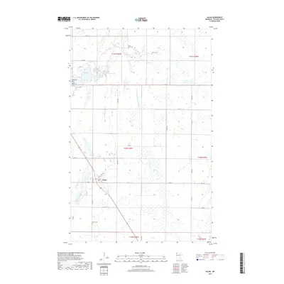
2019 Map of Halma
USGS Topo · Published 2019About this map
Halma serves as the central hub of this Kittson County landscape, positioned along the Soo Line railroad. The village is defined by its grid of streets, including Main St and Railroad Ave, which parallel the tracks that once drove the local agricultural economy. To the north, the waters of Lake Bronson are bordered by Cemetery Point, while the S Br Two Rivers meanders through the township. The surrounding prairie is characterized by a high concentration of small wetlands and drainage projects like State Ditch Number Fortynine. For genealogists, the map provides precise locations for several local burial grounds, including the Bronson Pioneer Cem, Nyren Burials Cem, Swanson Cem, and Eidsvold Cem, many of which sit on small rises above the surrounding marshes.
Find a feature on this map
35 named features on this map. Tap any name to fly to it.
Don’t see what you’re looking for? This feature index may not catch every label — zoom into the map to look around manually.
Map Details
Editions of this 2019 Halma Map
This is the sole edition of this map. No revisions or reprints were ever made.
Other maps of this area

1918 · Hemmington
USGS Topo · 1:62,500

1919 · Pelan
USGS Topo · 1:62,500

1930 · Juneberry
USGS Topo · 1:31,680

1932 · Juneberry
USGS Topo · 1:62,500

1952 · Thief River Falls
USGS Topo · 1:250,000

1956 · Thief River Falls
USGS Topo · 1:250,000

1956 · Karlstad
USGS Topo · 1:62,500

1957 · Thief River Falls
USGS Topo · 1:250,000

1957 · Pelan
USGS Topo · 1:62,500

1966 · Skull Lake SE
USGS Topo · 1:24,000