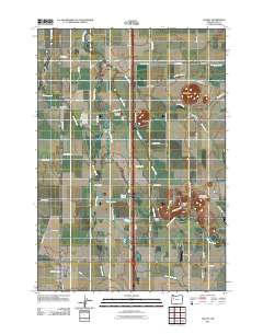
2011 Map of Halsey
USGS Topo · Published 2011About this map
The Calapooia River meanders through this agricultural landscape of the Willamette Valley, defining a complex drainage system that includes Sodom Ditch, Shedd Slough, and Spoon Creek. This 2011 survey illustrates the rural character of Linn County, anchored by the rail-aligned settlements of Shedd and Halsey. The importance of water management in this fertile region is evident from the presence of Thompson Dam and Sodom Dam, which regulate the intricate network of sloughs and creeks such as Wright Slough and Courtney Creek. Distinctive volcanic remnants like Saddle Butte and Ward Butte rise abruptly from the valley floor, providing significant local landmarks. For those exploring family history, the map precisely locates the Shedd Post Office and Halsey Post Office, alongside community anchors like the Pleasant Butte Baptist Cemetery and Bunker Hill Cemetery. Local aviation is represented by the J & J Airport, tucked between the river and the eastern foothills.
Find a feature on this map
58 named features on this map. Tap any name to fly to it.
Don’t see what you’re looking for? This feature index may not catch every label — zoom into the map to look around manually.
Map Details
Editions of this 2011 Halsey Map
This is the sole edition of this map. No revisions or reprints were ever made.
Other maps of this area

1909 · Harrisburg
USGS Topo · 1:31,680

1909 · Rowland
USGS Topo · 1:31,680

1911 · Brownsville
USGS Topo · 1:31,680

1911 · Lebanon
USGS Topo · 1:31,680

1911 · Tangent
USGS Topo · 1:31,680

1912 · Halsey
USGS Topo · 1:62,500

1913 · Oakville
USGS Topo · 1:31,680

1916 · Albany
USGS Topo · 1:62,500

1921 · Brownsville
USGS Topo · 1:62,500

1921 · Lebanon
USGS Topo · 1:62,500