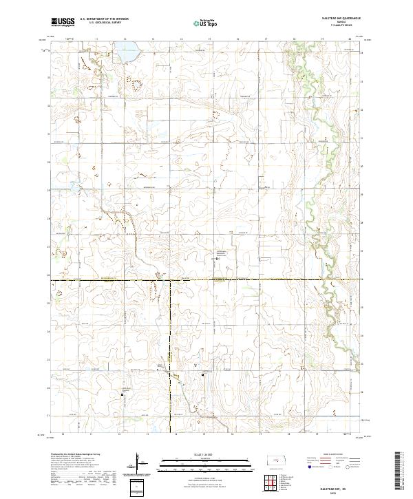
2022 Map of Halstead NW
USGS Topo · Published 2022About this map
Hoffnungsau Mennonite Church Cem and the surrounding farmland of the Kansas prairie mark a landscape defined by its religious heritage and gradual geological shifts. Situated at the junction where McPherson, Reno, and Harvey counties meet, the area is characterized by slow-moving waterways and subtle depressions. The presence of Lake Inman and the notable Big Sinkhole indicate the unique karst-like hydrology of this region, where surface drainage often feeds into underground formations. A network of rural section roads, including 13th Ave and Arapaho Rd, connects isolated cemeteries like Hebron Cem and Little River Township Cem, which serve as quiet markers of the families who settled this agricultural expanse. The intricate meanders of Turkey Cr and Big Slough highlight the natural drainage patterns that have shaped land use across these townships for generations.
Find a feature on this map
49 named features on this map. Tap any name to fly to it.
Don’t see what you’re looking for? This feature index may not catch every label — zoom into the map to look around manually.
Map Details
Editions of this 2022 Halstead NW Map
This is the sole edition of this map. No revisions or reprints were ever made.
Other maps of this area

1891 · Hutchinson
USGS Topo · 1:125,000

1893 · Hutchinson
USGS Topo · 1:125,000

1955 · Hutchinson
USGS Topo · 1:250,000

1959 · Hutchinson
USGS Topo · 1:250,000
1959 · Halstead
USGS Topo · 1:24,000
1959 · Burrton
USGS Topo · 1:24,000
1961 · Hutchinson SE
USGS Topo · 1:24,000

1964 · Conway
USGS Topo · 1:24,000

1965 · Mc Pherson South
USGS Topo · 1:24,000

1965 · Halstead NW
USGS Topo · 1:24,000